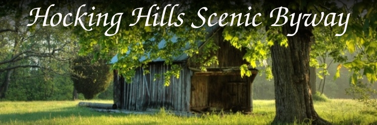
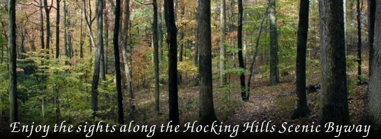
| There are many sites to see along the byway. Hocking Hills State Park is one of those sites. Hocking Hills State Park
provides many diverse recreational opportunities on the Hocking Hills Byway. Hike, swim, fish, spelunk, picnic, and camp to immerse yourself in the park's natural
wonders before relaxing in overnight accommodations ranging from campgrounds to cottages. Take part in a special event or nature program, offered throughout the year, or
stop by the visitor center at Old Man's Cave for gift shopping and interesting displays.
For more information and happenings in the Hocking Hills, visit
HockingHills.com. |
Mile 3.7 |
Mile
4.1 |
Mile
6 |
Mile
7.5 |
Mile
8.0 |
Mile
9.7 |
Mile 11.9 |
Mile 12.3 |
Mile 13.2 |
Mile 13.4|
Mile 18.1
Mile 18.6 |
Mile
19.7 |
Mile
21 |
Mile 21.4 |
Mile 21.7 |
Mile 23.3 |
Mile
24 |
Mile 24.8 |
Mile
26 |
Mile 26.4
Mile 3.7
About 3.3 miles past the Hopewell Mound, you will drive up a hill and see
the sign that announces you are entering the Hocking State Forest area.
The road curves around at the very top where you will notice newly
planted pine to help reforest our hills. You will see the beginning of the
giant hemlocks and tall pine trees. Many of the bigger pines were planted by
the CCC (Civilian Conservation Corp) in the 1930’s.
back to
top
Mile 4.1
About a half mile from the Hocking State Forest sign, at the top of the
hill, you will notice a large white house. This is the home of the Black CCC
Corp. These men planted the trees, created trails, and built some of the
structures found in the parks. At the time they lived here, segregation was
common. The house was the headquarters for the camp.
back to
top
Mile 6
Cantwell Cliffs State Park
1.9 miles past the CCC Camp Headquarters you will see the Cantwell Cliffs
parking lot. This is the first of the Hocking Hills State Park areas. The
park was named for Joshia Cantwell. Although it is least visited, many
visitors proclaim the Cantwell area as the most picturesque in Hocking
County.
You will see a little log cabin which serves as office headquarters for
the park rangers during the summer.
Each of the parks offers restful picnic areas to allow you to stop for a
rest. Picnicking is available year round.
Maps can be found displayed in each of the parks. Visitors are asked to
stay on the trails for their own safety. The deep valley, steep cliffs and
rock shelters of Cantwell Cliffs create a beautiful sight regardless of the
season. The erosion caused by Buck Run accounts for the depth of the valley
and the heights of the cliffs. Trails wind up through narrow passageways
caused by large slump blocks that have fallen away from the main cliff.
Cantwell Cliffs has a shelter house, as well as a picnic area. Family
picnics and large reunion gatherings make good use of these types of
facilities.
The hemlocks and pines are a pretty sight regardless of the time of year.
Their deep greens are especially welcome during the winter months. The parks
seem to have their own beauty in every season.
back to
top
Mile 7.5
1.5 miles past Cantwell Cliffs parking lot on Route 374 you will see a
large grouping of directional signs. Turn right to continue on 374 and the
Scenic Byway route.
This farm is one of the small farms that enhance the beauty of Hocking
County.
back to
top
Mile 8.0
The beautiful rock cliffs edge the right of Stoody Hill (named for the
farm owner). The left side is a wonderful ravine with an old farm with the
remains of a Mail Pouch barn.
A picturesque wall of water can be seen on the right, across from Mt.
Olive Road at the bottom of Stoody Hill. The
Wildflowers and Waterfalls
Tour also highlights numerous waterfalls throughout the area.
In the winter, the seepage through the rocks forms beautiful ice
formations for the eye to enjoy.
Near a big log house is a small cemetery that belonged to the Hanson
family. It is taken care of by the Laurel township trustees.
back to
top
Mile 9.7
At 23500 St. Rt. 180 in Rockbridge, Ohio is Spirits of the Hills Fine
Arts and Crafts Gallery. The Hocking Hills Region is home to many artists.
The Art of the Hocking Hills booklet is available at the Welcome Center. It
tells of many artists’ homes and studios.
back to
top
Mile 11.9
2.2 miles after Spirits of the Hills, you will come to the Village of
Mound Crossing, you will find a beautiful old farmhouse with a mound in its
backyard. This mound was built by the Hopewell Indians before the birth of
Christ. St. Rt. 374 originally ran around this mound. The road was
straightened and relocated about a half mile farther down. There used to be
a house built on the side of this mound, but it has since been torn down. A
few pieces of flint were found when the original house was built. The big
farmhouse is also the location of just one of our many craft and antique
shops scattered throughout the county.
After you pass Mound Crossing, you will notice the first hints of the
great American prairie on the right. This prairie extends all the way to the
Rocky Mountains. Farther on, the majestic Hocking Hills give way to gently
rolling fields and small rounded hills that look more like hay stacks. The
awesome standardizing effects of the Wisconsin glacier that came this way
about ten thousand years ago is in evidence everywhere. There are high
vistas where the distant horizon turns blue-black.
back to
top
Mile 12.3
Make sure to turn left to continue on State Route 374. The scenic byway
route is one of many winding roads found in Hocking County. Drive carefully
and enjoy the scenery.
back to
top
Mile 13.2
About a mile after the left turn, you will come to The
Nestled Inn was originally known as Little Denmark. It was one of the first
cabin rental businesses in the area. The picturesque countryside just seems
to invite you to stay.
back to
top
Mile 13.4
Rock House
The parking lot to Rock House, another area of the Hocking Hills
State Park is on the left. The Rock House is unique of all the Hocking
Hills State Parks because it is a true cave. It is a tunnel-like
corridor situated midway up a 150-foot Blackhand Sandstone cliff. The
"Rock House" is complete with seven Gothic-arched "windows" and great
sandstone columns which bear its massive roof. The Rock House has a
ceiling 25 feet high, while the main corridor is 200 feet long and 20 to
30 feet wide.
Rock House was used by many past visitors as a shelter. You will find
hominy holes, small recesses in the rear wall which served as baking ovens
for Native Americans. Past visitors have chiseled out "troughs" or "holding
tanks" in the stone floor of Rock House. These were used in the melting of
pine knots to make turpentine, which was used by the Indians and pioneers
for many things. It is believed that many not-so-welcome visitors used the
Rock House, like robbers and horse thieves, which earned the cave a
reputation of "Robbers Roost".
back
to top
Mile 18.1
Continuing on State Route 374 past the Rock House, is the Hocking State
Forest Headquarters. In the 1930’s the state built the buildings on this
site to house prisoners who were not a flight risk. The camp was called the
Hocking County Honor Camp. The actual camp was located about where the
garages now stand. These men planted trees, fought forest fires and helped
take care of the parks. A guard went with them wherever they went. It was
not necessarily economical, but it gave prisoners time in the outdoors and
to have an opportunity to learn new skills.
back
to top
Mile 18.6
A half mile past the Hocking State Forest Headquarters is Big Pine
Road, where Conkle’s Hollow State Nature Preserve is located (you’ll have to
make a turn off the Scenic Byway to visit Conkle’s Hollow State Nature
Preserve. From St. Rt. 374, turn left on Big Pine Road, and Conkle’s
Hollow’s parking area is just a few hundred feet away). This park is a
rugged, rocky gorge, one of the deepest in Ohio. The timeless beauty of the
rustic valley is surrounded by towering 240 foot Blackhand Sandstone cliffs protecting a
wilderness of hemlocks, birch, various trees, shrubs, ferns and wildflowers
in this beautiful gorge. The hollow was named for W.J. Conkle who left his
name and the date 1797 carved into the sandstone on the west wall of the
gorge.
The little white church you see at the intersection of 374 and Big Pine
Road is Pine Grove United Methodist Church and Cemetery. It was constructed
in 1886 with unique architecture: it has two separate entrances, one door
for the men and the other for the women. Although some modernization has
been done to the building, the original entry doors were left as a comment
on practices of the past. One of the graves in the cemetery belongs to Clyde
Huffman, a navy crewman of the USS Arizona. His body lies with his crewmen
in Pearl Harbor in Hawaii. His stone was placed at the church here as a
memorial for him.
back
to top
Mile 19.7
At the stop sign one mile past Big Pine Road, turn left to follow St.
Rt. 374 to Old Man’s Cave in the Hocking Hills State Park.
back
to top
Mile 21
The Hocking Hills Park System Dining Lodge, swimming pool, and rental
cabins are at the end of a mile long scenic driveway. The dining lodge
is open for breakfast, lunch and dinner from April until December. Drive
on up and see what’s on the menu!
back
to top
Mile 21.4
Welcome to Old Man’s Cave’s Visitor Center. You’ll find restroom
facilities, a museum display and a gift shop in the center (seasonal).
Old Man’s Cave is the hub of the Hocking Hills State Parks. The park gets
its name for Richard Rowe, a hermit, who lived in the area in the mid 1800’s
and is reported to have stayed here until his death. In this park, the creek
has carved a magnificent gorge through the entire depth of Blackhand
Sandstone. There are 2 sections: the Upper Falls and the Lower Falls. Trails
take you down from one to the other. The vertical cliffs reveal deep
recesses, potholes, and cracks that widen in some places so that massive
blocks of rocks have tumbled from the cliffs. The lush vegetation varies and
gives the eye a feast regardless of the season.
back to
top
Mile 21.7
This building is the headquarters for Old Man’s Cave Campgrounds and
the Hocking Hills State Parks. It opened in the fall of 2003. The new entry
to the campground winds up over the cliffs above the caves. There are
campsites available with electricity and water as well as primitive sites.
The campground is equipped with its own swimming pool also.
Just past the Hocking Hills State Park Headquarters, make sure you
turn right to continue on State Route 374. (Mile 22.2)
Along this portion of State Route 374, you’ll see the Primitive
Camping area and the parking lot to Rose Lake. Known for its fishing,
Rose Lake is only accessible by foot via the half-mile trail from its
parking lot.
back
to top
Mile 23.3
The Inn at Cedar Falls is one of the many fine restaurants and inns
found in Hocking County.
back
to top
Mile 24
Cedar Falls
On the right, you will see the beautiful curved block wall that graces
the entry to Cedar Falls. This park was named because early white settlers
mistook the towering hemlocks for cedar trees. Two deep grooves and numerous
potholes have been created by the action of the stream as it cascades over
the face of the Blackhand Sandstone. At one time a grist mill was located
just above these falls.
Across the road from Cedar Falls entry, stop for a look and listen to the
crystal clear stream as it flows down the hill over small boulders and
rocks. The shade from the hemlocks and pines make a very restful scene.
back to
top
Mile 24.8
A few yard past Chapel Ridge Road, look up over the tree line at the
top of the hill past Cedar Falls. You will see tucked away (almost hidden)
on a knoll, the Ash Cave Fire Tower. The tower was built in 1934 and still
stands. Visitors cannot climb the tower due to safety reasons. There were
some who wanted to raze the tower, but, it still stands to become a monument
to the many years of service these towers provided in keeping our Hocking
State Forest safe.
It is the hope of several people of the area to preserve the tower as a
historical element and have it refurbished as a lookout tower for tourists
in the future.
back to
top
Mile 26
Follow Rt. 374 to the junction of Rt. 56, you will turn to the right on
to Rt. 56.
back to
top
Mile 26.4
Ash Cave
The Shelter house lies across the road from the entry to Ash Cave. It is
just one of the areas that folks can find for a quiet picnic or resting
spot. The ancient Indian trail from the Pickaway Plains follows through this
park and visitors travel part of this old trail when they walk from the
parking lot at Ash Cave.
Most of the caves in our park system are recess caves. Ash Cave is the
largest and most impressive of this type of cave in the state of Ohio. The
rim spans 700 feet around to form a sandstone horseshoe. A misty waterfall
plunges 90 feet from the rim to the valley floor below. Huge mounds of ashes
discovered here by early settlers are thought to be ancient campfires of
early Indian inhabitants which gave this cave its name. The ashes were
excavated in 1877 to reveal many Indian artifacts as well as bones of
animals. The cave was a meeting place in early 1800’s. The shelter is large
enough to seat hundreds and the natural acoustics are excellent. Ash Cave
became an official park in 1925.
Just past Ash Cave on Rt. 56, look to your left to see another
beautiful small waterfall and spring that has been carved from the
rocks. What a cool and inviting spot to rest!
Continue along State Route 56, enjoying the rock outcroppings, small
waterfalls and creeks along side the scenic route. Many miles past Ash
Cave and just after Chapel Ridge Road, the Scenic Byway Route continues
by turning right on State Route 664. Eventually you will be back to
State Route 374 and will have officially driven the entire Hocking Hill
Scenic Byway. Turn left onto State Route 374 to continue back to US 33
the way you came on the Scenic Byway Route. Another option (and shorter
distance) back to US 33 would be to continue north on State Route 664 to
Logan. Following State Route 664 11 miles past Old Man’s Cave will lead
you to the Hocking Hills Regional Welcome Center, located at US 33 and
State Route 664.
Other Points of Interests on State Route 56
You may wish to continue on 56 (off the official Hocking Hills Byway
Route) to see more historic points of interest in Hocking County. Continue
past Ash Cave and past the St. Rt. 664 turn off and watch for the Narrows
Road sign on the left. This will take you to a very narrow valley area where
geologists believe ancient waters from the glaciers broke through to flow,
carve and create the valleys and gorges that make the Hocking Hills the
beautiful place that it is today.
Across the highway you’ll find a creek that flows along an old
Shawnee hunting trail. This trail connected the hunting grounds at the
Old Man’s Cave area with the Shawnee villages along the Scioto River
near present day Columbus. When settlers came to the area around 1790,
they found a large beech tree along this trail. The tree had a message
carved on it that say "this is the road to hell." Local legend says that
this was carved by some poor white captive on his way to his death
farther on in a Shawnee village.
Just past the Narrows Road, you will see a Bicentennial marker. This
marker was placed to honor the Salt and Hunting Trails that the Indians
traveled from the southern counties through the Hocking Hills region.
Salt was very important commodity – even more precious than gold. Stop
to read the marker and learn more about this ancient trail!
Watch on the same side of the road as the marker. You will see a giant
tree growing by itself in the middle of a farm field. This is Ohio’s biggest
Swamp White Oak. Some people call it the Giant Prairie Tree. These flat
lands that you see through this whole area are part of the Great Prairie
that stretches to the Rocky Mountains.
At 17212 St. Rt. 56, just east of Laurelville, you will pass one of
the oldest stone houses in the county. It was constructed of sandstone
with walls that are 22 inches thick! The house was built by Daniel
Karshner in 1820. Most of the wooden interior of this house is original.
The four wood-burning fireplaces in the house are still there, but no
longer used. The house today has been painted a sparkling white and
looks very much like many other farmhouses in the area. Hocking County
was only 2 years old when this house was built. What history it must
have seen through the view from its windows!
Further down the valley, the Shawnee trail passed near an ancient Mound
Builders mound that still rises boldly out of the ground. From a distance,
it resembles the top half of a giant basketball or baseball. The race of
people who built this mound disappeared from the earth centuries before
Columbus discovered America.
|